 |
|
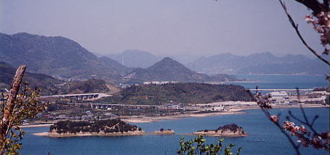
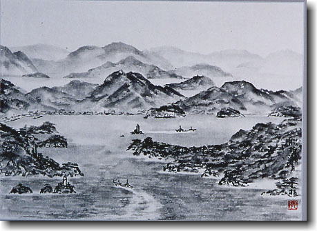
The Hakata island is the island of surrounding 50km
which is almost in the center of Seto Inland Sea.There is almost an island
in the middle of the bridge[The Shimanami sea way.] which connects Imabari
city with Onomichi city.The neighborhood of the island is surrounded by
Seto such as Haguriseto, Hunaoriseto, and a coastline is rich in the change.
The inside of the island is all right as for the view from the highest
Mt Hoko(height above sea level 304m) and Mt Hiraki (150m).As for Oomi
Island on the Onomichi city side, it is united respectively in the Oomijima
bridge in the Hakata Ooshima bridge as for the Imabari city side.The history
of the island was old, and a rope sentence, remains from March age were
left in it, and the Murakami water army was about to be useful in it in
the Muromachi Period. Though it knows at present as "Hakata no shio"[salt
name], Shiota-cho is the nursery of the lobster and the flatfish long
ago.
|
|
|
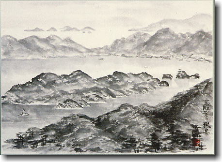
Hanaguri seto
|
| It is exceptionally small, and the difference in ebb and
flow of the tide reaches 4m, and the flow of the tide becomes 15km per hour
in Seto between next Oomi Islands by whether as well to be é╚ of Seto Inland
Sea, too. The biggest dangerous place in Imabari, the space of the Onomichi
line is said. There is much Seto around here in Hunaoriseto, Miyatsuboseto,
Yugeseto, and so on. |
|
|
Oomi shima
|
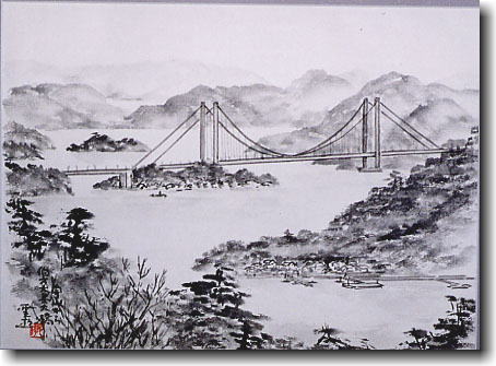
| The arch bridge of the entire length 328m which Hakata
Island and Oomi Island take. The flow of the tide of Hanaguri, Seto whom
the bridge opened in 1979 hangs on is fast, and reaches 15km per hour, too,
and he, Seto, that the bridge opened in 1979 hangs it is the dangerous place
of the line. As for this bridge, not becoming a hindrance of the navigation
of the ship is being considered. And, not spoiling a surrounding scene is
being considered. |
|
|
Hunaori seto
|
| Seto between Hakata Island and Oo Island is small with
the width 300m. Urotsu, Seto, is said, too. The navigation of the ship is
difficult because the flow of the tide is fast and almost curves at right
angles. There are Nojima which was the headquarters area of the Murakami
water army, and Niwatorikojima, Kojima such as Ujima near here. Mijika Island
is put between Oo Islands, and Hakata Ooshima, Oohashi, spans it. |
|
|
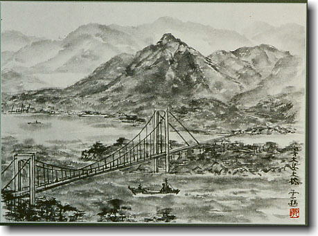
Hakata Ooshima big bridge
|
| The continuous bridge of the bridge which spans Hakata
Island and Oo Island and which is being hung, and the beam bridge. The part
island side to put a pier on Mijika Island which is here in the middle and
which öī is the bridge of 384m which the beam bridge of 325m, Oo Island üy
a side üz hang. It was opened in 1988. A Niwatori kojima lighthouse is near
here. |
|
|
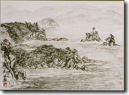
Niwatori kojima lighthouse
|
| This lighthouse is a lighthouse to stand on Niwatori kojima
just near Hakata ooshima big bridge. As for this, height goes on and off
once in the white lighthouse of 6.5m at night in every 4 seconds, and the
light reaches it to 17km ahead. |
|
|
Mt,Hoko
|
| This mountain is almost in the center of Hakata Island,
and height above sea level is the one for some 304m. This mountain is compared
to Mt Fuji, and there is another name of Hakata Fuji in it. As for the view
from this mountain, Seto's bridge can be seen well. |
|
|
Mt,Hiraki
|
| This mountain is on the west side of Hakata
Island, and height above sea level is 149m. A view is wonderful though it
isn't high such as Mt, Hoko. Seto's bridge can be seen from this mountain
as well. |
|
|
Hunaoriiwa lighthouse
|
| This lighthouse stands on Hunaoriiwa in Hunaori seto between
Hakata Island and Niwatori Island. This is the red lighthouse of the height
8.5m. It is called with the red lighthouse toward the white lighthouse of
Niwatori kojima. A solar battery is adopted in the power supply, and light
reaches to 13km ahead. A ship sees a lighthouse on the starboard side, and
this lighthouse must pass by the starboard sign lighthouse. |